Showing posts with label Water Trail. Show all posts

Saturday, January 11, 2014

United States Coast Guard - Jan. 2014


United States Coast Guard, Safety on the Bay
January 2014

The United States Coast Guard plays a leading role in the safety, security and stewardship of the San Francisco Bay. This multi-mission, federal agency’s hands-on expertise with vessels of all types and search and rescue operations, also puts them in a great position to share helpful tips and information with potential Water Trail users.

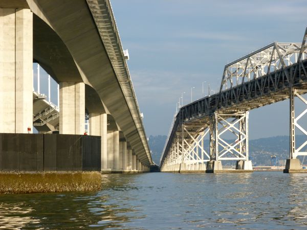
Recently, we visited with the Director and members of the United States Coast Guard (USCG) Vessel Traffic Service (VTS) team. The group was co-located with the USCG Sector San Francisco Interagency Operations Center, and local Station, in between San Francisco and Oakland in a strategically central site on Yerba Buena Island, “under” the San Francisco Bay Bridge.

Vessel Traffic Service in Action
On January 8, 2014, we visited the U.S. Coast Guard Sector and Station San Francisco. This Sector, part of the larger District 11, serves a large area of the West Coast, north and south of San Francisco Bay, the Sacramento Delta, and as far east as the Tahoe Basin.

The first stop on our trip, that was arranged by Thomas Boone (Training, VTS), was the Vessel Traffic Service areas where USCG personnel monitor and help manage commercial ship traffic. 

Commercial ship traffic entering the Bay is monitored from 38 miles out. Speed and position data are tracked closely as they approach and cross under the Golden Gate Bridge.

There were a few paper charts on the walls. However, these charts were largely being phased out in favor of sophisticated software and graphics display technology. 

We watched as operators manned large color monitors, and listened to up to 5 channels at once, to ensure ferry boats, tanker ships, cruise ships, and many other types of crafts were operating within designated traffic lanes and guidelines. While they may not have been able to spot smaller, human-powered craft on this scale, it was a comfort to see the great care and coordination being taken with the larger vessels.

The command and control operations and Vessel Traffic Service (VTS) personnel at work, combined with operation ready rooms in the same building, exemplified the United States Coast Guard motto, Semper Paratus ("Always Ready"). As part of this readiness, local, state and federal inter-agency communications and cooperation was also evident.

Communications were ongoing with the bar pilots who were accompanying large tankers into the Bay. Other government agencies could also be conferred with. For example, local ferries could be contacted to help pick up kayakers, windsurfers and boardsurfers or sailers in distress.

Last, but not least, we were impressed to learn that in addition to all their usual daily operations that includes watching for terrorists, drug smugglers and ne'er do wells, the Coast Guard also monitors thousands of permitted events on the water each year (regattas, races, Alcatraz swims, etc.).

What Happens When a Call Comes In?
Lt. Jeannie Crump (Public Relations, Vessel Traffic Service) explained what might happen when a call comes in to the command center.

If a recreational boater calls in for help, calls get logged, prioritized and routed to the closest Station. Station San Francisco may get the call and send a response boat out, depending on the location and circumstances. (There are also response boats stationed at other points in the SF Bay. Station Golden Gate often deals with situations out in the Pacific, beyond the Golden Gate Bridge, and is perhaps the busiest Station on the West Coast.)

If the weather is good, the sun is out, and a kayaker is stuck on the mudflats (at low tide) and the tide is due to come back in within an hour, they may stay in communications with the caller but not send someone out. They consider the situation. If there is bad weather, imminent danger and the person's cell phone is running out of battery, that situation would be handled differently, Crump explained.

Sean E. Kelley (Director, Vessel Traffic Service) agreed with Crump, and also mentioned Prevention Through People, a group whose efforts resulted in videos and resources to help ensure boaters were better prepared. (See also Additional Resources section at the end of this article.)

USCG Vessels
After lunch, we walked across a lawn to the dock area. It was a slightly overcast day, with no rain in sight. This month marked the third year of drought on the West Coast, while the Eastern U.S. had recently been hit with record cold and snow.

Weather conditions do matter in this line of work. Heavy fog, or heavy wind or seas can create challenges for boaters of all types. And many rescue situations result from a combination of lack of preparation and change in weather conditions.

Moored in the dock outside were two USCG Cutters (ships over 65 feet in length), and two smaller, newer Response Boats: a 25-foot boat that could access shallower waters in the Bay, and a larger 45-foot boat, involved in (and well prepared for) search and rescue and other operations.

We met Christopher Martin (Engineering Petty Officer, EPO). He kindly invited us to take a closer look.

Equipped for rough weather, the 45-foot Response Boat was impressive. It was stocked with an infrared camera system (that might allow them to “see” a person, or animals, in the water at night), and many other modern features, allowing for speed, comfort (for survivors). The new boat also allows for quick and easy access to engines (which need to be checked at regular intervals during operations and drills).

“We’ve been able to cut time considerably for engine checks with these new boats. We can check engines from computer screens now” (inside the cockpit, rather than opening large watertight hatches in 20-foot seas and crawling into small spaces with hot engine parts.)

The boat also was designed to right itself quickly if rolled over in heavy seas. Fortunately, heavy seas are rare inside the Golden Gate Bridge; however, that doesn’t mean the agency doesn’t receive several search and rescue related calls each day, about windsurfers, kayakers and other small watercraft owners who were having issues.

Activity on the dock had a precisely organized feel to it. USCG personnel boarding boats were decked out in bright orange and black body suits that would keep them relatively warm, dry and buoyant for training operations on/in the water. And, every line (rope) with tightly coiled in place. (It was the type of impressive efficiency that inspired me to better organize my life when I got back home.)

“We’re always training, operating and maintaining,” said Martin, echoing the Always Ready motto.

Stewardship
In addition to maritime security and safety, the USCG also responds to and maintains reports on oil spills and environmental hazards, and is involved in estuary clean-up efforts. 

VTS Director, Sean E. Kelley, recalled recent efforts to clear the 100-foot tug Respect that had sunk near Alameda. "In addition to demolish and recycle efforts, there was old fuel and other substances to deal with."

Please don't spill anything in the water, Lt. Jeannie Crump added. "We have to respond to every call, and that takes money and time -- time we might be able to spend on a rescue or other important operation."

Kayakers, windsurfers and boardsurfers, and the occasional swimmer spending time in the water, will likely appreciate these efforts.

Tips
  • Carry/Wear a Personal Floatation Device (PFD)
  • Know before you go - check tides, conditions
  • File a float plan - let a friend or family member know where you’ll be
  • Make sure kayaks, other crafts have adequate lighting at nighttime
  • Call the USCG command center to report emergencies or spills
  • Give tugs a wide berth - to avoid being affected by “prop wash” (100 yards minimum)
  • Kayaks, windsurfers and other human powered equipment need to yield to larger ships (who can't see smaller crafts) in certain areas; so familiarize yourself with vessel traffic and shipping lanes in the area. (See also Rules 5 and 9.)

When Martin was asked about what misconceptions people might have about going out onto San Francisco Bay, he suggested that, in addition to normal preparations, people remember how cold the water is in the Bay. Being in the water, even for several minutes can be an issue. This is why having PFDs on (for those 12 and under) or readily accessible onboard (for adults) at all times (according to Federal law) is so important.

Martin also put in a good word for the U.S. Coast Guard Auxiliary. “They’re fantastic, and they help us a lot,” he added.

Additional Resources

Note: Special thanks to Thomas Boone (Training Asst.) and VTS for making this visit and interview possible, and to Galli Basson, Water Trail Planner, and Ann Buell, California State Coastal Conservancy Project Manager, who have worked to make the Water Trail a reality.

Tuesday, October 8, 2013

Sup. Dave Cortese - Day on the Bay in Alviso - Oct. 2013

Photo: Dave Cortese website
Supervisor Dave Cortese Discusses the Water Trail, Alviso
October 8, 2013

This interview was spurred by the fourth annual Day on the Bay (October 13, 2013), in Alviso, CA, at the southern end of San Francisco Bay. While overlapping with San Jose, CA, Alviso has a special history all its own, and (the Alviso Marina) will be celebrated as a designated Water Trail site this week. Supervisor Dave Cortese, a founder of the Day on the Bay celebration, was excited about Alviso's rich cultural past as well as the area's bright prospects for the future.

I caught up with the busy Santa Clara County Supervisor, who represents District 3, by phone.

(Note: after the interview, this post was updated on Oct. 20, '13, to include photos of the Day on the Bay 2013. Photos appear below. The event was a success, and several dozens of people waited in line for kayak rides after the Alviso Marina site was officially designated.)

How did you become interested in the San Francisco Bay Trail and the San Francisco Bay Area Water Trail? 

"(I'm) one of the Supervisors who has a lot of assignments at the regional level. I was appointed to the Association of Bay Area Governments (ABAG), and was the president of ABAG for (a while). I then was appointed to the Metropolitan Transportation Commission (MTC), and various committees.

I received a report on the Water Trail and a Powerpoint presentation, and became interested. I was chairing a meeting and talked with Laura Thompson (ABAG SF Bay Trail project mgr.) about following up on (promoting) the County Marina (in Alviso). "Do we qualify for being a part of this (Water Trail)?" I thought.

In a perfect world, what would be your vision of the San Francisco Bay Water Trail?

I have a desire for Alviso to be (the) South Bay's version of (what) the Bay should be.

Each of the major cities have, as part of their identity, a port, e.g. Port of Oakland, or San Francisco;  and we have lesser versions of the same kind of relationships (Redwood City). Then you have San Jose, a large city, with lots of bayfront. (And) it's a big secret.

I noticed that you're involved in the Silicon Valley Kids Climate Club. What are you seeing in the next generation of leaders that might help ?
Alviso - Day on the Bay

Yes, young people in Alviso are aware (about the Bay and climate change). It's in their back yards. I visited Alviso schools where they were very close to the water. The embrace the shoreline.

Those kids are no different than the other 450,000 (approximate #) of other kids in Santa Clara County. It's almost tragic. There is a dramatic underutilization of a natural resource. It's a perfect natural laboratory -- and one way to put Alviso back on the map,... (we haven't had something like this) since the days of Jack London.*

The South Bay can become perhaps the best recreation access point, with nature, the marine ecosystem (that we have). It's a great opportunity to create a place (on the Trail) where we have sunshine almost year round. We have a marine access point to Don Edwards Wildlife Refuge (DEWR, aka Don Edwards SF Bay National Wildlife Refuge) that we haven't capitalized on in Santa Clara County.

I talk to kids -- in Santa Cruz, San Diego, other cities (water is a major part of their identity, yet it hasn't caught on here). Yet, when you look at what we built -- bay access to DEWR. There isn't any major city that has that.

Do you have a favorite water craft of type of boat (kayak, canoe?) that you, or your family, have enjoyed taking out on the Bay?

No, I'm not really there quite yet. I love getting outdoors, as much as my schedule permits. I do have two boys, who may be interested. We'll probably get into this soon.

Are there any misunderstandings that the public seem to have about the Bay Trail or the Water Trail that prevent them from fully enjoying these public resources?


(There is a) basic lack of information. For example, there was a big car show last week. I was meeting with some people there. And one of the kids asked where (the Bay Trail, Marina and Water Trail) were? This, even though we were just a few miles away.

Just designating Alviso (as part of the Water Trail on Sunday, October 13), will help increase awareness. (Kayakers will be there at the unveiling to paddle from the marina out into the Bay. See photos.)

The last two photographs of kayaks at Alviso (taken before the event): Courtesy of Galli Basson

*Famous author Jack London used to boat down to Alviso. Supervisor Cortese mentioned old photographs that show Alviso's rich history. "Wedding receptions were held there, groups of judges hung out there, there were farm families (who influenced the area)." Cortese acknowledged that some may have been put off by the large sewage treatment plant that was built in the area; but there are many other things to see (such as the educational center by the water, walking trails (Bay Trail, Guadalupe River Trail), and the historic town of Alviso itself).

Tuesday, August 6, 2013

Kayaking the Water Trail with Galli Basson - Aug. 2013

Kayaking in Oakland with Galli Basson
August 6, 2013

I can think of no better person to talk about the San Francisco Bay Area Water Trail than Water Trail Planner, Galli Basson. We kayaked together in Oakland and discussed the Water Trail. We started at California Canoe and Kayak (in Jack London Square) and headed south, paddling around Coast Guard Island and back. Thank you Galli for the helpful updates and kayak tips.

WTS: Tell me about Galli Basson, and how you came to be working on the San Francisco Bay Area Water Trail?


GB: My background is in biology; I have a masters degree in Environmental Studies, and did research on the Bay. Previously, I worked as an open space planner, and I really liked planning trails.

I was attracted to the Water Trail because it was new and cutting edge. I was drawn to the opportunity to be creative and shape something new.

WTS: What is the SF Bay Area Water Trail, and what inspired the concept?

GB: Sometimes it's hard to describe. I tell people the Water Trail (WT) is a network of sites around the Bay where people in non-motorized small boats can access the Bay. It's not necessarily linear; people can go in any direction. It supports a wide variety of crafts and experiences -- from mild to wild.

The WT is also about information - about getting information to people about the sites, safety, about wildlife, and about connecting people to each other, to clubs and outfitters.

It started with a group of human-powered boaters representing all kinds of crafts: wind surfers, kayakers, all types. They saw they were losing access to sites due to development or just due to deterioration. So they banded together, and they realized a comprehensive approach was what was needed to save access; and they formed a non-profit called Bay Access.

Bay Access is still active, and involved with implementation.

Long term, the WT will continue to benefit from continuing involvement of a non-profit, especially when it comes to developing stewardship programs.

WTS: How do I find the Water Trail, and is it designed for different types of boats?

GB: Right now the best way to find it is to go to the Water Trail website. We have information on classes, where you can rent craft, all the different clubs and recreation programs, safety, wildlife you can see, and of course the sites we have designated.

And, yes, the WT has been designed to support multiple types of boats.

Soon, you'll be able to find our (Water Trail) signs at the launch sites. And eventually we'll have a paddle-friendly lodging network, as well as a stewardship program for people who are interested in getting involved.

WTS: What is your favorite, or personal, water craft of choice?

GB: My husband and I own kayaks and we've had a ball exploring the Bay. I love being out on the water. But, one of my goals is to try all the different boat types.

WTS: What advice do you have for those wanting to explore the Water Trail?

GB: I would suggest that people take classes, join a club, or go on a guided tour the first time. There's a lot to learn before going out on the Bay, about currents, weather, tides, cold water, and boating around other vessels. But there are ways to do it safely and you can learn the skills. There are some very family friendly locations on the Bay and there are some more wild locations on the Bay.

(Editors note: Certain "friendly" sites may become more challenging with changes in the weather. But, qualitative descriptions of sites provide a good starting point.)

WTS: What has surprised or delighted you most about this project? What are the biggest misconceptions people have about the Water Trail?

GB: What surprises me is how diverse the Bay is and how many world class experiences can be had so close to home.

A common misconception about the WT is that we will build these access sites. Many of these sites are existing sites; and our job is not to build the trail but instead to improve the facilities, provide information to the public, foster partnerships, and participate in regional planning of access to the Bay.


Saturday, December 22, 2012

Alameda Shipping Channel - Nov. 2012

Alameda - Amidst the Ships  
November 27, 2012

I recently went out on a sailboat with Ken Hauck in Alameda. We experienced the veritable calm before an advancing storm; it was a dark afternoon, with slivers of sunlight on the water.

It was so calm, in fact, we decided to motor out of the channel instead of hoisting the sails. We headed roughly north toward the San Francisco Bay Bridge (that spans between San Francisco and Oakland, with Treasure Island in between). We crossed under the bridge and turned around, returning to Alameda just in time to view a great sunset.

A small map (by Studio L'Image) insert shown (above right) shows the general area where we were today. The map can be seen in its entirety at SF Bay Water Trail site.

When I walked along the Bay Trail (on the shore) near the Port, I marveled at the variety of different boats moving to and fro in such a narrow channel (that can be barely seen on this small map). Some kayakers venture into this shipping channel where we were today, but I felt a bit safer seeing this area by larger boat.

Red spots on the map indicate access facilities/ramps in place; black dots indicate possible future put in and take out spots. The closest red dot to where we were was the Tidewater Boating Center.

The real fun was seeing all the working ships and crafts of all sorts in this industrial area. On the way out of the Alameda Marina we caught sight of Coast Guard Island across the channel on the Oakland side, and three large USCG ships that were docked there. We passed some houseboats, and caught glimpses of Jack London Square.

We also maneuvered around large container ships going in and out of the Port of Oakland. It was a great spot different types of tug boats at work. International container ships loaded flats of cars like they were small toys.

Ken originally learned to sail in the Eastern U.S., in 1973, and when he moved west to work in the technology industry he started sailing in the San Francisco Bay in 2003.

He feels a connection to the Alameda area -- a location that allows easy access to some of the best sailing on the West Coast. I asked Ken some questions about what he liked best about his boat and sailing in the Bay.

What type of boat to you have?
It's a 1979 Catalina 38. It's noteworthy because the hull was designed by naval architectural firm, Sparkman and Stephens. It's a design made to conform to the IOR racing rules prevalent in the 1970s, and it used to be the class boat for the Congressional Cup match race in Southern California.

What do you like best about your boat?
It's a good size to sail SF Bay, it handles the typical high summer winds well, and it's big enough to be stable and comfortable for the usual waves in the Bay. Because of its racing heritage, it's also fun to sail!

What do you like best about being out on San Francisco Bay?
Everything! The views, the great sailing winds, the weather and sharing it all with friends.


Is there anything about the Alameda area (where you keep your boat) special for you?
It's where I was introduced to SF Bay sailing when I dropped in at an open house at the Catalina dealer in Marina Village and found my boat. It has great services for boaters and it's fun going out the channel past other marinas, Jack London Square (Oakland), the old Navy airfield (Alameda), and the Oakland container shipping docks.


Are there any trends or changes you've noticed since you've been sailing on SF Bay?
Not really; it feels about the same as in 2003. But I have enjoyed watching the Bay Bridge getting built, and also some of the development south of Market (Street) in San Francisco.

Any memories or stories you'd like to share about being on the Bay?
Lots of memories, mostly good times with friends. Watching the Blue Angels (jets) perform near Alcatraz during Fleet Week. Sailing to Angel Island to picnic and spend the night moored in the cove. Seeing lots of marine life, including sea lions, sea otters, dolphins and even a pair of humpback whales once near Angel Island.

Image of San Francisco Bay Water Trail map is from San Francisco Bay Water Trail website.


Thursday, December 20, 2012

Building Tule Boats - November 2012


The Original San Francisco Bay Water Trail 
November 17,  2012

A few centuries ago, several tribes in California made canoe-like boats from bundles of tule (reeds) that had been cut, dried and woven together. These tule boats, and sometimes rafts, were used for hunting, fishing and transportation in and around San Francisco Bay.

I became interested in tule boats when I saw them on display in museums and visitors centers during my 1,000 mile walk around San Francisco Bay, following the San Francisco Bay Trail. I was fortunate to find a few people last month (November 2012) who knew how to build tule boats, and was able to witness two tule boats come to life on a drizzly Saturday in Marin County.

Charles Kennard, studied basket weaving with a Pomo Indian woman, and applies tools and weaving techniques he learned to the art of tule boat building. "Reed boats are a natural extension of basketry," and a "practical test of one's skills," he explained. He built his first tule boat in 1997 and has, more recently, taken boats out on Corte Madera Creek and where the watershed meets the Bay.

It turns out Kennard built some of the tule boats I saw on my walk around the bay. I caught up with him at a workshop for a group of students participating in an Aim High program in the Tennessee Valley area (west of area shown on Marin area map) about a mile inland from the Pacific Ocean.

I arrived mid-way in the boat construction process, taking place inside a large horse barn. The barn had plenty of covered space to build two tule boats. A previously built canoe-style tule boat was suspended against one wall.

The students were working quickly in teams, and bundles were coming together on the floor.  Rope was being braided and readied to help tie bundles together. Snippets of tule and rope covered the wood floor, along with bits of straw from hay bales. Horses gazed out from their stalls at the work in progress.

While cutting and drying of the tule had happened earlier, I was amazed that two boats could be built and taken out on the water in one day. The materials used were simple but very effective. A carved deer bone tool, that looked perfectly shaped for the job, was used to help fasten or weave bundles together. The bottom and sides of the boat came together quickly.

The front end of this particular boat design came to a high point and the back had a chopped off look. I was told that there were likely at least four different tule boat designs that were used in San Francisco Bay Area. (Other tule boats, and in fact whole tule islands, can be found in Mexico, Peru and other countries.)

I asked Kennard why tules were so well suited for boats. "The interior of the stems consist of narrow, 1/2 inch long air-filled cells, making them buoyant," he explained. That was a good description of the structural advantage of tule. However, it doesn't fully explain the emotional connection one feels in actually creating and floating in one of these craft, as I was about to experience. This feeling, Kennard later commented, was not unusual; and he credits the elemental and historic nature of the material for inspiring this connection. I couldn't help but wonder if we'd lost something of value (such as working with free, sustainable resources, with our own hands) over time.

Once completed, the boats were inspected, loose tule ends were trimmed with a knife. And the boats were carefully lifted and carried outside to a truck, where they were loaded, placed together, on their sides. Boats and students were transported to a large pond toward (but inland from) the beach. Life jackets were donned, safety instructions given, and kayak paddles were used to help maneuver boats into the water.

It was a joy to watch the students experience being afloat and learning how to direct the boats. After all the students were finished taking a turn, I was able to take a short paddle around the pond. It was wonderful. The boat felt sturdy, stable and maneuverable, and I really appreciated the opportunity. A big thank you to Charles Kennard; Richard Lautze and Elizabeth from Aim High; and all the students (former students and staff) who did such a great job creating the boats.

Image of San Francisco Bay Water Trail map is from San Francisco Bay Water Trail website.